PLC - HERE
SOW - HERE
Hot Deserts
CW Date:
Title:
Introduction - Hot Deserts
Entry Task:
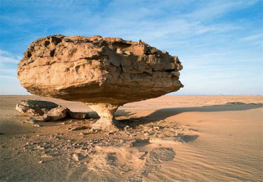
Describe this environment.

Key Terms:
Activity:
Describe and explain the global distribution of hot deserts and suggest what characteristics make them unique environments.
Hot Deserts:
These environments cover some 30% of the planet's land area and are defined largely by precipitation which is generally regarded as being less than 250mm/pa, unreliable from year to year and frequently arriving in intense downpours.
These conditions lead to a barren environment with very limited vegetation cover most of the time.
Temperatures can be very high e.g. 40oC although there is often considerable diurnal range (temperatures may drop to around freezing at night.
The conditions described above are the result of one or more of the following factors:
- Latitude(Global Atmospheric Circulation)
- Distance from Oceans (Continentality).
- Relief (Rain Shadow effect).

The effect of latitude.
This is largely linked to the effect of global atmospheric circulation on the amount of precipitation received at different latitudes north and south of the equator.
Rising air at the equator results from the high levels of insolation received there throughout the year. This causes convection storms on a daily basis as moisture is released by the cooling of air as it rises into cooler altitudes. As this air reaches the upper atmosphere it is forced to flow laterally to the north or south. At around the Tropics, the air has cooled sufficiently to increase in density and begin to descend again. As the air is descending it warms which increases its volume and, consequently, its capacity to hold onto any moisture it may possess. As a result, there is very little cloud formation (due to condensation) or rainfall at these latitudes (around 23oN and S of the equator).

Effect of continentality.
Large land masses tend to have dry interiors since air that penetrates that far have often lost their moisture through precipitation events caused either by local relief or convection.

The above image shows a continentality index in which the colours represent the difference between the mean temperature of the warmest and coolest months. It reveals greater variation in temperature further from the ocean. The displacement toward the Mediterranean results from the westerly air flows in this region. A similar continental effect is seen in relation to precipitation, except that rainfall levels tend to be lower with greater distance from the ocean as air masses precipitate more of their water vapour closer to the ocean.
The effect of relief (Rain shadows)
Mountain ranges can cause land to their lee-side to be deserts through orographic uplift of incoming air masses. Uplift cools the air causing condensation of water vapour. As the air flows into the lee of the mountains it is drier and, because it is descending, becomes warmer and expands in volume thus increasing its capacity to hold any moisture still present. Thus there is little or no condensation, cloud formation and precipitation.

What makes deserts unique environments?
Due to their specific climatic conditions and the effect of this processes at work, deserts are unique environments. Their landscapes are often perceived as barren though they are generally not lifeless and may burst with life during periods of rainfall. The absence of continous vegetation cover plays a role in the way that earth-shaping processes operate. For example, rocks may be exposed to winds that carry rock grains so that they become polished and shaped into unusual forms (see below).

Due to the relatively rare occurrence of rainfall and the paucity of vegetation cover, surface runoff is more significant in arid environments. As a result fluvial erosion can significant in shaping landscapes.
Vegetation too is unique in arid regions as it has evolved to cope with drought and heat causing the development of specific forms and life-cycles.
CW Date: 2018
Title:
The Hot Desert System
(Above already done... quick review).
Feedback from previous assignment... especially aspect that make these environments unique.
Tasks 1, 3 and 4 pp 61
Completed?
CW Date: 2018
Title:
Characteristics of Hot Deserts and their Margins.
Entry Task:
Feedback about the Desert System... task 4 from last lesson...
Key Terms:
Climate -
Soil -
Xerophytes -
Oasis -
Diurnal -
Climate:

Interactions:
 Soil:
Soil:Soil is a mixture of organic matter, minerals, gases, liquids, and organisms that together support life. The Earth's body of soil is the pedosphere, which has four important functions: it is a medium for plant growth; it is a means of water storage, supply and purification; it is a modifier of Earth's atmosphere; it is a habitat for organisms; all of which, in turn, modify the soil.

A, B, and C represent the soil profile, a notation firstly coined by Vasily Dokuchaev, the father of pedology; A is the topsoil; B is a regolith; C is a saprolite, a less-weathered regolith; the bottom-most layer represents the bedrock.
Interactions...
Gersmehl Diagram...


Read pp 62/63.
Complete tasks 1 and 2 pp 63.
(Above already done... quick review).
CW Date: 6th February 2018
Title:
Entry Activity:
Climate graph check... Not done by many... finish (15 mins)
Key Terms:
Latent Heat -
Arid -
Semi Arid -
The definition of semiarid is a climate or place that is partially arid, or semi-dry and has less than 50cm of rain each year.
Alternatively...
An arid environment can be defined as one in which the amount of precipitation an area receives, divided by the amount which is lost to evapotranspiration, yields a fraction which is less than 0.50.
Activities:
1. Review question 2 pp 63
2. Referring to pp 64, outline the role that Latent Heat plays in convection in the atmosphere.
HW (due first lesson back after 1/2 term):
Describe and explain the factors that are responsible for the formation of the Atacama desert (mini Geographical essay - ie located, illustrated, including maps and hand drawn diagrams as appropriate).
3. For presentation to the class:
Choose another Hot Desert and prepare a presentation to outline its location and causal factors... illustrations and maps are required).
CW Date: 7th February 2018
Title: Causes of Aridity
Key Terms:
Lapse Rate -
Adiabatic Lapse Rate -
Latent Heat -
(You should be able to define at end of session.)
Activities:
1. Discursive review of questions on pp 65... if there are problems here, set as written task.
(This includes some elements that will help in explaining the Atacama desert)
2. Re-read the section about Latent Heat on pp 64
3a. How does Latent Heat contribute to the extremes of temperature?
Notes/explanation:
The Lapse Rate is the rate at which temperature falls with increasing altitude.
The standard lapse rate (Environmental Lapse Rate - ELR) averages c 5.7oC/1000m increase in altitude.
However, the rate varies depending on the amount of moisture in the air so we identify both Dry and Saturated Lapse Rates (DALR and SALR).
Air becomes saturated when it is holding the maximum amount of moisture possible. The amount of moisture actually in the air compared to the amount the air is capable of holding is termed Relative Humidity.
When rising air ascends and it cools down, its ability to hold onto moisture declines. At what is called the Dew Point, moisture begins to condense out of the air because the RH has exceeded 100%.
Condensation releases heat - Latent Heat... why?
When moisture evaporates a change is taking place which requires energy. This energy is extracted from the surrounding environment which cools as a consequence. If moisture condenses, the energy absorbed by evaporation is released back into the surroundings as Latent Heat which serves to warm the surrounding area and which may encourage convection.
Diurnal effect of Latent Heat:
So... in a desert... where it is both hot and dry...
...during the day, heating by radiation from the ground has very little (if any) moisture to evaporate and thus no evaporative cooling takes place.
...at night, when it is cooler, the absence of moisture means that the radiated (heat) energy is not prevented from escaping by atmospheric moisture (which if present and evaporating would absorb the heat and store it).
NL 19th February 2018
3b. Which phase is represented by the following diagram?

3c.Make a copy, give it an appropriate title and then draw a similar diagram to illustrate what happens at day/night (depending on which this one represents...)
Global effect of Latent Heat:
This is where Lapse Rates come into play...
Average Lapse Rate Values:
ELR - c 5.7oC/1000m altitude increase/decrease
DALR - c 9.8oC/1000m altitude increase/decrease
SALR - c 6oC.1000m altitude increase/decrease
Remember too that as air temperature changes, its ability to hold moisture alters... cooling air can hold less and warm air more. The point at which air must begin to release moisture by condensation is 100% RH.
Thus, if air rises enough to cool sufficiently so that its ability to hold moisture is reduced and the RH becomes 100%, it will begin to release vapor as droplets. This process releases Latent Heat of course and may encourage continued uplift by convection provided the rising air temperature remains above that of the surrounding air.
How do the Lapse Rates operate?

4a. Make a copy and then...
4b. Calculate the temperature of the air at 4000m (rising) from a start temperature of 20oC at ground level (before uplift).
4c. What will be the temperature of the air as it returns to ground level?
5. How does this illustrate the global scale cause of extreme temperatures in Hot Desert areas?
CW Date: 21st February 2018
Title:
Hot Desert Vegetation
Entry Activity:
Suggest how these xerophytes are adapted to Hot Desert climates
How might the vegetation in this photograph be influencing conditions in different parts of the photo?

Key Terms:
Xerophyte - Plants that have morphological and physiological adaptations that allow survival in conditions of water deficit.
Succulent plants - A group of xerophytes that have adaptations that permit the storage/retention of water e.g. thick, waxy cuticle.
Metabolism - chemical processes that occur within a living organism in order to maintain life
Dormant - "Sleeping". To be in a state when metabolic rate is significantly reduced or halted in order to conserve energy. Dormancy will thus also reduce the demand for water in plants.
Notes:
How do plants adapt to hot desert environments?
Xerophytic plants have a number of responses to hot and dry conditions. These can be broadly divided into approaches that:
1. Avoid drought by, for example, tapping into deep underground supplies via an extended root system ("tap root") or alternatively having a very rapid life cycle so that it is complete in a short period of time if and when water becomes available leaving behind seeds ready to sprout again in the next rains.
2. Increase Drought resistance which includes periods of dormancy when conditions are dry, slow metabolic rate, leaf-shedding etc.
3. Involve Water storage - such plants are known as succulents and include cacti. They are able to store water in their cells and conserve this by possession of waxy/leathery skins. They also tend to have wide-spreading and shallow root systems... Why?

Q.1. What xerophytic adaptation is operating here?


Q. 2. See activity sheet - HERE
3. Select another xerophytic plant (your choice), make a sketch, label and annotate to outline the mechanisms it is using to cope with the climatic conditions of Hot Deserts.
HW/Flipped Learning Activity:
Make a case study of the Great Basin Desert in the USA to explain how topography contributes to its aridity.

Example and Feedback case study - HERE
CW Date: February 2018
Title:
Water Balance in Hot Desert Environments.
Entry Activity:
1. Atacama Desert feedback - NB Missing papers (Callum, Lucas and Harry...?) - HERE
2. Collect the Great Basin Desert Flipped/HW
Key Terms:
Convection storm
Overland Flow/Surface Run-off
Evapotranspiration
Aquifer
Exogenous
Endoreic
Ephemeral
What makes the Desert Water Cycle Distinctive?
Notes: 1. Total rainfall levels are low (Less than 250mm/pa), but when it does rain, it falls in intensive bursts (convection/thunder storms).
2. Rainfall intensity (above) leads to overland flow/surface runoff (this is actually quite rare in temperate regions).
3. Short periods of rainfall (and associated cloud cover/heat) lead to high rates of evaporation.
4. Potential Evapotranspiration Rates (PET) are high (sometimes 10 times precipitation). Actual Evapotransiration is generally low due to the absence of precipitation.
5. A proportion of water available in hot deserts may be via Aquifers. As a proportion of total available water, due to low precipitation, this may constitute a higher proportion than in other climates. Aquifers may reach the surface as springs (forming oasis) or be extracted by drilling/digging wells (Note that fossil aquifers provide water in some deserts... these are not being replenished and are a finite resource).
6. Desert rivers may have Exogenous, Endoreic and Ephemeral sources.
Aridity Index
This is the ration between the mean annual precipitation and the mean annual evapotranspiration rate i.e. P:PET where P is precipitation and PET is Potential Evapotranspiration.

The Water Balance
This statistic is usually expressed as:
Precipitation = Evaporation +/- Storage + Runoff
Obviously the two sides of this formula are in balance as all precipitation will become either evaporation, stored water or constitute runoff.
In a desert, however, where temperatures are very high and the air is dry, evaporation will likely form a much greater proportion of the water balance (PET is high and Precipitation is low). The results of this are seen in the paucity of vegetation and the specialist adaptations that plants make in order to survive.
In the Water Balance for hot desert, there is little storage or runoff (eg in form of rivers) and so no "surplus" water is available for human activity such as agriculture, industry of settlement... In human terms, then, deserts can be considered as places of water deficit where water has to be imported or extracted from aquifers.
CW Date:
Title:
Desert Systems: Energy and Sediment Cells
Entry Activity:
Feedback on GBD case study - HERE
Key Terms:
Activities:
Make summary notes on pages 68/69 (Read and then write!) - See Kerboodle notes (DNo)
Complete research activity: Quick research (brief note + illustration). Landforms resulting from the action of wind in arid environments
NL:
Activites
CW Date: 7th March 2018
Title:
Weathering in Hot Deserts.
Entry Activity:
What is weathering?
Examples from previous studies?
Key Terms:
Activities from the text (onto wk sheet) - HERE
Complete and HI (on paper)
Follow up activities:
1. Explain the differences between weathering and erosion.
2. What is mass movement and what are the key forces involved in it?
3. Using labelled illustrations explain the three thermal fracture processes likely to take place in deserts.
4. How do Salt crystalisation and frost shattering operate in hot deserts?
5. Answer question 2 on pp 71.
Completion for NL
CW Date: 13th March 2018
Title: Development of Desert Landscapes (Importance of water, vegetation, paleoclimates and diurnal changes in temperature)
Entry Activity:
Feedback from activity 2 from last session:
Produce a labelled sketch of the photo below to demonstrate that weathering is both varied and active in this environment.
Hand in for checking and Feedback.

Key Terms:
Fluvial - related to water and specifically rivers.
Ephemeral - temporary/shortlived
Aeolian - related/caused by wind
Pediment - a broad, gently sloping expanse of rock debris extending outwards from the foot of a mountain slope, especially in a desert.
Pediplain - an extensive plain formed in a desert by the coalescence of neighbouring pediments.
Peneplain - is a low-relief plain formed by protracted erosion
Activities:
A.
Read through and discuss the Geofile provided (HERE) - Arid and Semi-arid Landscapes and Landforms.
B.
Using the Geofile provided and wider research...
1. Outline how diurnal changes in temperature can contribute to the development of a desert landscape.
Isaac, Harry, Ollie, George
2. Evaluate the importance of water in creating distinctive landscapes in hot deserts.
Callum, Henry, Lucas
3. To what extent may it be argued that desert landscapes are the product of paleoclimates rather than present day conditions?
Joe, Dan
4. How does the sparseness of vegetation in hot deserts contribute to distinctive landscapes and land forms in deserts?
Fran, Tilly, Thashkin, Shallom, Miya
Guidance:
Research and prepare a presentation (using google slides) responding to your allotted title.
This should include:
Each presentation must be accompanied by notes/materials for the audience.
CW Date:14th March 2018
Title: Understanding the Desert as a System
GPOP re Assigned questions: HERE (Draft)Entry Activity:
Key Terms:
Activities:
Notes:
Deserts are open Systems consisting of the following elements:
What do you understand by these terms... can you give examples in relation to deserts?
The desert landscape is dynamic (changing), but also is in a state of balance. This is understood as being in a state of "dynamic equilibrium" whereby changes occur, but do not self perpetuate and transform the environment so that it achieves an alternative state. i.e. lack of change in a system as inputs and outputs remain in balance. If changes do occur, then feedback will allow for correction.
Consider the following situation:
A rainstorm occurs and stimulates the rapid proliferation of vegetation. The vegetation changes the micro-habitat and environment for example by improving infiltration capacity of soil and increasing rates of erosion and weathering due to salt crystal growth, exfoliation etc. Plants grow due to available moisture, supporting an increase in the population of fauna. They complete their life cycle then die back contributing organic matter to the soil. Dry conditions follow and localised wind patterns lead to aeolian transportation which removes plant debris, weathering and erosion processes return to "normal" and animal populations balance with resources available. Soil returns to high mineral and low organic content, water retention is poor... conditions return to those in place prior to rain event... short term and small scale changes do not lead to long term alteration of the system.
The desert system can be viewed as a combination of processes that lead to land forms that, together, create a landscape that shares specific attributes such as dryness (lack of surface water), exposed rock structures, limited vegetation cover and increasingly low relief due to the progressive erosion and weathering of surfaces and the absence of significant layers of soil capable of protecting the surface (Note that low relief may exist in deserts that also have high altitude).
CW Date: 16th March 2018
Title:
What is the role of Wind in Hot Deserts?
Entry Activity:
Key Terms:
Activities:
Reading and understanding the text.
See Source Sheet - HERE
Feedback draft doc - HERE
CW Date: 18th April 2018
Title: Deflation and Dunes
Entry Activity:
Feedback from last session...
Key Terms:
Deflation Hollows - A feature caused by surface excavation by wind.
Sand Dunes - Accumulations of wind-transported sand forming sculpted hills.
Aeolian - Pertaining to wind

Sand storm in the Namibian Desert
Activities:
1. With reference to a named example that you have studied, outline the nature of deflation hollows and describe how deflation can influence desert landscapes.

2. Describe and explain the form of sand dunes (include diagrams in your answer).
3. Produce a mind map entitled "the role of water in hot deserts" (in pairs if choose, but make sure that you copy/share the final product).
Example of a mind map below...

Source and Why mind map? - HERE
CW Date: 24th April 2018
Title: Landforms formed by water in hot deserts
Entry Activity:
Feedback from mind maps... "show and tell"
Key Terms:
Activities:
Complete the activities on the...
Source sheet - HERE
CW Date: 8th May 2018
Title: Changes in the extent of Hot Deserts over time.
Source doc: HERE
Entry Activity:
What is/are the key determinant/s of the distribution of hot deserts?
Key Terms:
Carbon Dating -
Radiocarbon dating (also referred to as carbon dating or carbon-14 dating) is a method for finding the age of materials containing organic compounds. It employs the relative amount of the carbon dioxide isotope C-14. This is only accumulated while an organism is alive and upon death, the amount of C-14 declines (radioactive decay) at a predictable rate. Thus, the less C-14 present the older the sample.
Pollen Analysis - microscopic identification and quantification to analyse the range of plant pollens present in soil/sediment layers: these can tell us what crops, vegetation or ground cover were likely to have been present when a layer was deposited.
Pollen is part of the reproductive system of plants - tiny grains are discharged like dust from the male Pollen grains are distinctive to each plant species and sub-species, and their tiny and dense structure mean that they survive well in many soil types for thousands of years. Radiocarbon dating is commonly used to date these layers so that the changing pollen presence over time can be measured.
Interactions...
Gersmehl Diagram...


Read pp 62/63.
Complete tasks 1 and 2 pp 63.
(Above already done... quick review).
CW Date: 6th February 2018
Title:
Entry Activity:
Climate graph check... Not done by many... finish (15 mins)
Key Terms:
Latent Heat -
Arid -
Semi Arid -
The definition of semiarid is a climate or place that is partially arid, or semi-dry and has less than 50cm of rain each year.
Alternatively...
An arid environment can be defined as one in which the amount of precipitation an area receives, divided by the amount which is lost to evapotranspiration, yields a fraction which is less than 0.50.
Activities:
1. Review question 2 pp 63
2. Referring to pp 64, outline the role that Latent Heat plays in convection in the atmosphere.
HW (due first lesson back after 1/2 term):
Describe and explain the factors that are responsible for the formation of the Atacama desert (mini Geographical essay - ie located, illustrated, including maps and hand drawn diagrams as appropriate).
CW Date: 7th February 2018
Title: Causes of Aridity
Key Terms:
Lapse Rate -
Adiabatic Lapse Rate -
Latent Heat -
(You should be able to define at end of session.)
Activities:
1. Discursive review of questions on pp 65... if there are problems here, set as written task.
(This includes some elements that will help in explaining the Atacama desert)
2. Re-read the section about Latent Heat on pp 64
3a. How does Latent Heat contribute to the extremes of temperature?
Notes/explanation:
The Lapse Rate is the rate at which temperature falls with increasing altitude.
The standard lapse rate (Environmental Lapse Rate - ELR) averages c 5.7oC/1000m increase in altitude.
However, the rate varies depending on the amount of moisture in the air so we identify both Dry and Saturated Lapse Rates (DALR and SALR).
Air becomes saturated when it is holding the maximum amount of moisture possible. The amount of moisture actually in the air compared to the amount the air is capable of holding is termed Relative Humidity.
When rising air ascends and it cools down, its ability to hold onto moisture declines. At what is called the Dew Point, moisture begins to condense out of the air because the RH has exceeded 100%.
Condensation releases heat - Latent Heat... why?
When moisture evaporates a change is taking place which requires energy. This energy is extracted from the surrounding environment which cools as a consequence. If moisture condenses, the energy absorbed by evaporation is released back into the surroundings as Latent Heat which serves to warm the surrounding area and which may encourage convection.
Diurnal effect of Latent Heat:
So... in a desert... where it is both hot and dry...
...during the day, heating by radiation from the ground has very little (if any) moisture to evaporate and thus no evaporative cooling takes place.
...at night, when it is cooler, the absence of moisture means that the radiated (heat) energy is not prevented from escaping by atmospheric moisture (which if present and evaporating would absorb the heat and store it).
NL 19th February 2018
3b. Which phase is represented by the following diagram?
3c.Make a copy, give it an appropriate title and then draw a similar diagram to illustrate what happens at day/night (depending on which this one represents...)
Global effect of Latent Heat:
This is where Lapse Rates come into play...
Average Lapse Rate Values:
ELR - c 5.7oC/1000m altitude increase/decrease
DALR - c 9.8oC/1000m altitude increase/decrease
SALR - c 6oC.1000m altitude increase/decrease
Remember too that as air temperature changes, its ability to hold moisture alters... cooling air can hold less and warm air more. The point at which air must begin to release moisture by condensation is 100% RH.
Thus, if air rises enough to cool sufficiently so that its ability to hold moisture is reduced and the RH becomes 100%, it will begin to release vapor as droplets. This process releases Latent Heat of course and may encourage continued uplift by convection provided the rising air temperature remains above that of the surrounding air.
How do the Lapse Rates operate?
4a. Make a copy and then...
4b. Calculate the temperature of the air at 4000m (rising) from a start temperature of 20oC at ground level (before uplift).
4c. What will be the temperature of the air as it returns to ground level?
5. How does this illustrate the global scale cause of extreme temperatures in Hot Desert areas?
CW Date: 21st February 2018
Title:
Hot Desert Vegetation
Entry Activity:
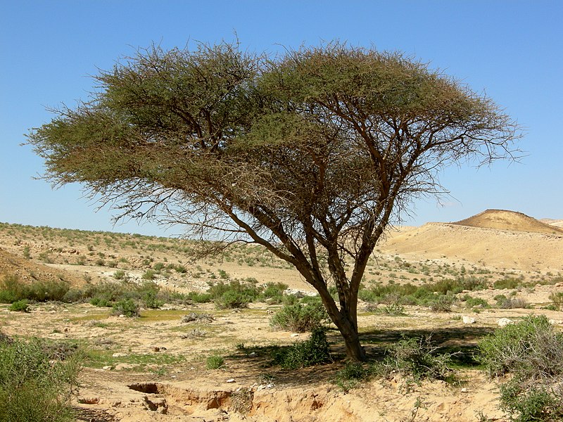
Suggest how these xerophytes are adapted to Hot Desert climates
How might the vegetation in this photograph be influencing conditions in different parts of the photo?
Key Terms:
Xerophyte - Plants that have morphological and physiological adaptations that allow survival in conditions of water deficit.
Succulent plants - A group of xerophytes that have adaptations that permit the storage/retention of water e.g. thick, waxy cuticle.
Metabolism - chemical processes that occur within a living organism in order to maintain life
Dormant - "Sleeping". To be in a state when metabolic rate is significantly reduced or halted in order to conserve energy. Dormancy will thus also reduce the demand for water in plants.
Notes:
How do plants adapt to hot desert environments?
Xerophytic plants have a number of responses to hot and dry conditions. These can be broadly divided into approaches that:
1. Avoid drought by, for example, tapping into deep underground supplies via an extended root system ("tap root") or alternatively having a very rapid life cycle so that it is complete in a short period of time if and when water becomes available leaving behind seeds ready to sprout again in the next rains.
2. Increase Drought resistance which includes periods of dormancy when conditions are dry, slow metabolic rate, leaf-shedding etc.
3. Involve Water storage - such plants are known as succulents and include cacti. They are able to store water in their cells and conserve this by possession of waxy/leathery skins. They also tend to have wide-spreading and shallow root systems... Why?
Xerophytes are typified by presence of a number of adaptations:
- Reduced leaves – reducing the total number and size of leaves will reduce the surface area available for water loss
- Rolled leaves – rolling up leaves reduces the exposure of stomata to the air and hence reduces evaporative water loss (spines of a cactus for example)
- Thick, waxy cuticle – having leaves covered by a thickened cuticle prevents water loss from the leaf surface (Aloe)
- Stomata in pits – having stomata in pits, surrounded by hairs, traps water vapour and hence reduces transpiration. Stomata opening is inhibited by higher humidity.
- Low growth – low growing plants are less exposed to drying wind and more likely to be shaded by other plants or ground features, reducing water loss
- CAM physiology – plants with CAM physiology open their stomata at night, reducing water loss via evaporation
(Crassulacean acid metabolism - involves storage of energy from insolation until night-time when photosynthesis can take place with less water loss through evapouration).
Q.1. What xerophytic adaptation is operating here?
Q. 2. See activity sheet - HERE
3. Select another xerophytic plant (your choice), make a sketch, label and annotate to outline the mechanisms it is using to cope with the climatic conditions of Hot Deserts.
HW/Flipped Learning Activity:
Make a case study of the Great Basin Desert in the USA to explain how topography contributes to its aridity.

Example and Feedback case study - HERE
CW Date: February 2018
Title:
Water Balance in Hot Desert Environments.
Entry Activity:
1. Atacama Desert feedback - NB Missing papers (Callum, Lucas and Harry...?) - HERE
2. Collect the Great Basin Desert Flipped/HW
Key Terms:
Convection storm
Overland Flow/Surface Run-off
Evapotranspiration
Aquifer
Exogenous
Endoreic
Ephemeral
What makes the Desert Water Cycle Distinctive?
Notes: 1. Total rainfall levels are low (Less than 250mm/pa), but when it does rain, it falls in intensive bursts (convection/thunder storms).
2. Rainfall intensity (above) leads to overland flow/surface runoff (this is actually quite rare in temperate regions).
3. Short periods of rainfall (and associated cloud cover/heat) lead to high rates of evaporation.
4. Potential Evapotranspiration Rates (PET) are high (sometimes 10 times precipitation). Actual Evapotransiration is generally low due to the absence of precipitation.
5. A proportion of water available in hot deserts may be via Aquifers. As a proportion of total available water, due to low precipitation, this may constitute a higher proportion than in other climates. Aquifers may reach the surface as springs (forming oasis) or be extracted by drilling/digging wells (Note that fossil aquifers provide water in some deserts... these are not being replenished and are a finite resource).
6. Desert rivers may have Exogenous, Endoreic and Ephemeral sources.
Aridity Index
This is the ration between the mean annual precipitation and the mean annual evapotranspiration rate i.e. P:PET where P is precipitation and PET is Potential Evapotranspiration.
- Hot deserts have Aridity Index of 0.2 (20% of precipitation needed is actually received)
- Semi-Arid regions have index of 0.2 to 0.5 (20% to 50% of necessary precipitation is received)
| Classification | Aridity Index | Global land area |
|---|---|---|
| Hyperarid | AI < 0.05 | 7.5% |
| Arid | 0.05 < AI < 0.20 | 12.1% |
| Semi-arid | 0.20 < AI < 0.50 | 17.7% |
| Dry subhumid | 0.50 < AI < 0.65 | 9.9% |
The Water Balance
This statistic is usually expressed as:
Precipitation = Evaporation +/- Storage + Runoff
Obviously the two sides of this formula are in balance as all precipitation will become either evaporation, stored water or constitute runoff.
In a desert, however, where temperatures are very high and the air is dry, evaporation will likely form a much greater proportion of the water balance (PET is high and Precipitation is low). The results of this are seen in the paucity of vegetation and the specialist adaptations that plants make in order to survive.
In the Water Balance for hot desert, there is little storage or runoff (eg in form of rivers) and so no "surplus" water is available for human activity such as agriculture, industry of settlement... In human terms, then, deserts can be considered as places of water deficit where water has to be imported or extracted from aquifers.
CW Date:
Title:
Desert Systems: Energy and Sediment Cells
Entry Activity:
Feedback on GBD case study - HERE
Key Terms:
Activities:
Make summary notes on pages 68/69 (Read and then write!) - See Kerboodle notes (DNo)
Complete research activity: Quick research (brief note + illustration). Landforms resulting from the action of wind in arid environments
NL:
Activites
CW Date: 7th March 2018
Title:
Weathering in Hot Deserts.
Entry Activity:
What is weathering?
Examples from previous studies?
Key Terms:
Activities from the text (onto wk sheet) - HERE
Complete and HI (on paper)
Follow up activities:
1. Explain the differences between weathering and erosion.
2. What is mass movement and what are the key forces involved in it?
3. Using labelled illustrations explain the three thermal fracture processes likely to take place in deserts.
4. How do Salt crystalisation and frost shattering operate in hot deserts?
5. Answer question 2 on pp 71.
Completion for NL
CW Date: 13th March 2018
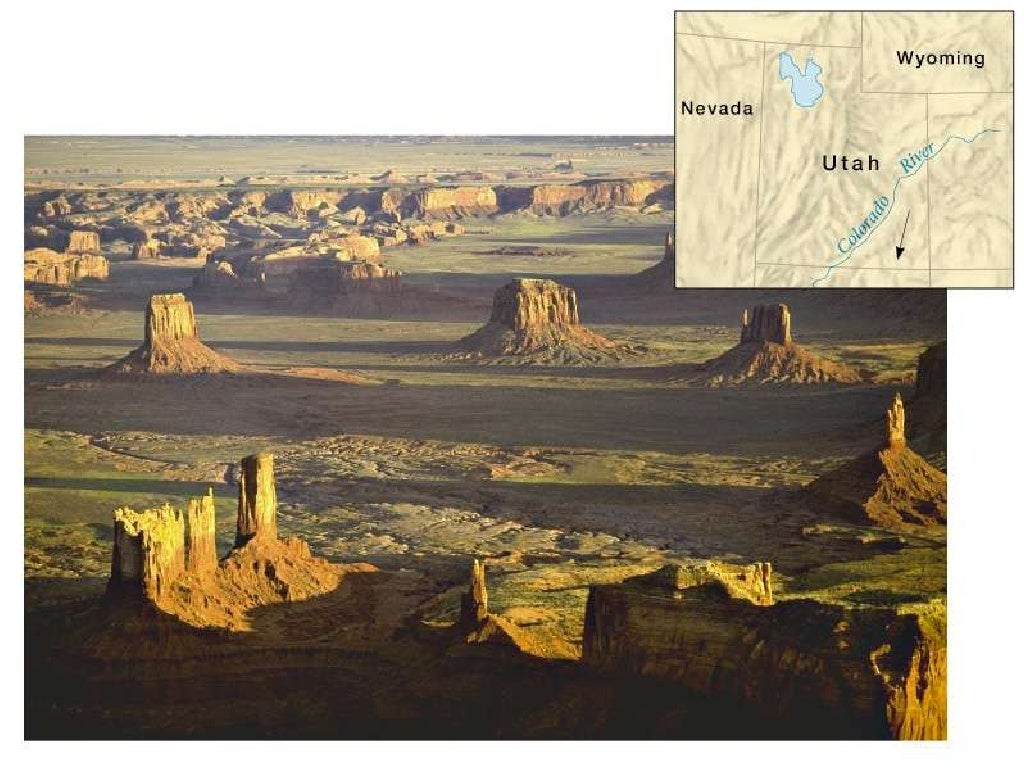
Title: Development of Desert Landscapes (Importance of water, vegetation, paleoclimates and diurnal changes in temperature)
Entry Activity:
Feedback from activity 2 from last session:
Produce a labelled sketch of the photo below to demonstrate that weathering is both varied and active in this environment.
Hand in for checking and Feedback.
Key Terms:
Fluvial - related to water and specifically rivers.
Ephemeral - temporary/shortlived
Aeolian - related/caused by wind
Pediment - a broad, gently sloping expanse of rock debris extending outwards from the foot of a mountain slope, especially in a desert.
Pediplain - an extensive plain formed in a desert by the coalescence of neighbouring pediments.
Peneplain - is a low-relief plain formed by protracted erosion
Activities:
A.
Read through and discuss the Geofile provided (HERE) - Arid and Semi-arid Landscapes and Landforms.
B.
Using the Geofile provided and wider research...
1. Outline how diurnal changes in temperature can contribute to the development of a desert landscape.
Isaac, Harry, Ollie, George
2. Evaluate the importance of water in creating distinctive landscapes in hot deserts.
Callum, Henry, Lucas
3. To what extent may it be argued that desert landscapes are the product of paleoclimates rather than present day conditions?
Joe, Dan
4. How does the sparseness of vegetation in hot deserts contribute to distinctive landscapes and land forms in deserts?
Fran, Tilly, Thashkin, Shallom, Miya
Guidance:
Research and prepare a presentation (using google slides) responding to your allotted title.
This should include:
- The full title.
- Explanation of the title and how you have interpreted it.
- Delivery of your broad response in precis form, followed by sections where you explain and develop your broad response and provide specific evidence to support your view.
- Provide a conclusion that returns to the title in a clear and concise manner.
Each presentation must be accompanied by notes/materials for the audience.
CW Date:
Title: Understanding the Desert as a System
GPOP re Assigned questions: HERE (Draft)Entry Activity:
Key Terms:
Activities:
Notes:
Deserts are open Systems consisting of the following elements:
- Inputs
- Components/Stores (known as "Sinks")
- Transfers/Flows
- Outputs
What do you understand by these terms... can you give examples in relation to deserts?
The desert landscape is dynamic (changing), but also is in a state of balance. This is understood as being in a state of "dynamic equilibrium" whereby changes occur, but do not self perpetuate and transform the environment so that it achieves an alternative state. i.e. lack of change in a system as inputs and outputs remain in balance. If changes do occur, then feedback will allow for correction.
Consider the following situation:
A rainstorm occurs and stimulates the rapid proliferation of vegetation. The vegetation changes the micro-habitat and environment for example by improving infiltration capacity of soil and increasing rates of erosion and weathering due to salt crystal growth, exfoliation etc. Plants grow due to available moisture, supporting an increase in the population of fauna. They complete their life cycle then die back contributing organic matter to the soil. Dry conditions follow and localised wind patterns lead to aeolian transportation which removes plant debris, weathering and erosion processes return to "normal" and animal populations balance with resources available. Soil returns to high mineral and low organic content, water retention is poor... conditions return to those in place prior to rain event... short term and small scale changes do not lead to long term alteration of the system.
The desert system can be viewed as a combination of processes that lead to land forms that, together, create a landscape that shares specific attributes such as dryness (lack of surface water), exposed rock structures, limited vegetation cover and increasingly low relief due to the progressive erosion and weathering of surfaces and the absence of significant layers of soil capable of protecting the surface (Note that low relief may exist in deserts that also have high altitude).
CW Date: 16th March 2018
Title:
What is the role of Wind in Hot Deserts?
Entry Activity:
Key Terms:
- Deflation -
- Abrasion -
- Transportation:
- Surface Creep
- Saltation
- Suspension
Activities:
Reading and understanding the text.
See Source Sheet - HERE
Feedback draft doc - HERE
Title: Deflation and Dunes
Entry Activity:
Feedback from last session...
Key Terms:
Deflation Hollows - A feature caused by surface excavation by wind.
Sand Dunes - Accumulations of wind-transported sand forming sculpted hills.
Aeolian - Pertaining to wind
Sand storm in the Namibian Desert
Activities:
1. With reference to a named example that you have studied, outline the nature of deflation hollows and describe how deflation can influence desert landscapes.
2. Describe and explain the form of sand dunes (include diagrams in your answer).
3. Produce a mind map entitled "the role of water in hot deserts" (in pairs if choose, but make sure that you copy/share the final product).
Example of a mind map below...
Source and Why mind map? - HERE
CW Date: 24th April 2018
Title: Landforms formed by water in hot deserts
Entry Activity:
Feedback from mind maps... "show and tell"
Key Terms:
Activities:
Complete the activities on the...
Source sheet - HERE
CW Date: 8th May 2018
Title: Changes in the extent of Hot Deserts over time.
Source doc: HERE
Entry Activity:
What is/are the key determinant/s of the distribution of hot deserts?
Key Terms:
Carbon Dating -
Radiocarbon dating (also referred to as carbon dating or carbon-14 dating) is a method for finding the age of materials containing organic compounds. It employs the relative amount of the carbon dioxide isotope C-14. This is only accumulated while an organism is alive and upon death, the amount of C-14 declines (radioactive decay) at a predictable rate. Thus, the less C-14 present the older the sample.
Pollen Analysis - microscopic identification and quantification to analyse the range of plant pollens present in soil/sediment layers: these can tell us what crops, vegetation or ground cover were likely to have been present when a layer was deposited.
Pollen is part of the reproductive system of plants - tiny grains are discharged like dust from the male Pollen grains are distinctive to each plant species and sub-species, and their tiny and dense structure mean that they survive well in many soil types for thousands of years. Radiocarbon dating is commonly used to date these layers so that the changing pollen presence over time can be measured.
Biome - distinct biological communities that have formed in response to a shared physical climate. Biomes generally cover large areas and thus represent the biological community typical of a specific climate region.

Activities:
1. Skills Development:
Activity 2 pp 86.
i.e.
For completion during NL and as HW (deadline 14th May 2018)
2. How have the changing conditions in the Sahara impacted on human activity?
Wider reading: HERE and follow up questions:
What is desertification and to what extent does it pose a threat?
Ref. pp 88-93 of the core text + Wider reading (ensure that sources are cited as footnotes if used in your narrative and that a full reading list is added at the end of your paper).
Deadline 14th may 2018
CW Date: 14th May 2018
Title: Desertification - Review and Geographical Skills (Ao3)
Entry Activity:
Define "desertification"
Key Terms:
Activities:

Complete the skills activities 1 and 2 above...
Essay:
CW Date: 22nd May 2018
Title:
Entry Activity:
Essay planning
Key Terms:
Activities:
Page - 96 Activities 1,2,3,5,6 (Q4 already done in a form)
Followed by...
Qs pp 97 re field data... dunes.
CW Date: 6th June 2018
Title:
Revision/consolidation - Hot Deserts
Entry Activity:
List the sub-topics covered in the unit on Hot Deserts. This list can be added to your folder (at the front of the Deserts section) and could be adapted for use as a contents page and/or revision list.
Key Terms:
Activities:
See source sheet - HERE
Plenary:
Activities:
1. Skills Development:
Activity 2 pp 86.
i.e.
- Using info from fig 2 pp 87, draw a compound (divided) bar graph to represent the period 22,000BP to present (at scale of 1cm : 1,000 yrs).
- Divide the bar into time segments (from the table fig 2) and colour code each segment to reflect climate conditions. Make a key to explain.
- Add labels and annotations to describe the conditions associated with each time period identified.
For completion during NL and as HW (deadline 14th May 2018)
2. How have the changing conditions in the Sahara impacted on human activity?
Wider reading: HERE and follow up questions:
- What evidence is presented for the African Humid Period?
- How do the authors explain the climatic changes in the Sahara?
- What are the implications of the reports findings?
What is desertification and to what extent does it pose a threat?
Ref. pp 88-93 of the core text + Wider reading (ensure that sources are cited as footnotes if used in your narrative and that a full reading list is added at the end of your paper).
Deadline 14th may 2018
CW Date: 14th May 2018
Title: Desertification - Review and Geographical Skills (Ao3)
Entry Activity:
Define "desertification"
Key Terms:
Activities:
Complete the skills activities 1 and 2 above...
Essay:
CW Date: 22nd May 2018
Title:
Entry Activity:
Essay planning
Key Terms:
Activities:
Page - 96 Activities 1,2,3,5,6 (Q4 already done in a form)
Followed by...
Qs pp 97 re field data... dunes.
CW Date: 6th June 2018
Title:
Revision/consolidation - Hot Deserts
Entry Activity:
List the sub-topics covered in the unit on Hot Deserts. This list can be added to your folder (at the front of the Deserts section) and could be adapted for use as a contents page and/or revision list.
Key Terms:
Activities:
See source sheet - HERE
Plenary:
No comments:
Post a Comment
Note: only a member of this blog may post a comment.